Showing posts with label himalayas. Show all posts

Jan 31, 2016

Khardung La-Panamik-Leh

J&K complete logs here.


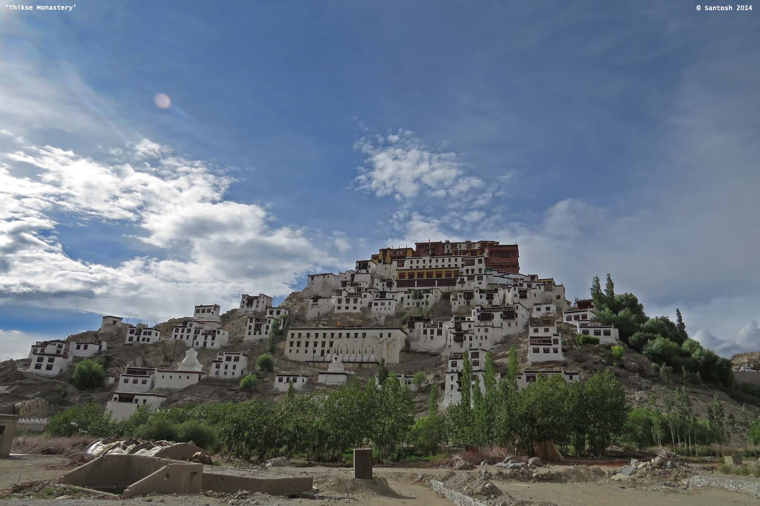
We took a day off after arriving in Leh, a little tired of the long travel done so far and we used the day to acclimatize and look around Leh and we also had to get the vehicle checked. Thikse monastery was the only place we visited in Leh and we couldn’t manage any other sightseeing. Next day would be a big day as we would be traversing through Khardung La. We also utilized the spare day to do some shopping, pick up essentials, fill up the vehicle tank and get the permits (just in case if it is asked for somewhere).


[Idol inside the monastery (top) and view from the monastery (above)]

Next day, we were up early and all set to traverse through the highest motorable road in the world situated at an altitude of 18380 FT! Our plan was to reach Panamik from Leh passing through North Pulu, Khardung La and South Pulu.


Khardung La is a hot spot for tourists, especially bikers who ride in all kinds of bikes (bullets are invariably the preferred choice); stay on the top for a while and either proceed back or halt at Panamik. High altitude has its problems and for people not used to heights, precaution needs to be taken else you could easily be affected by the High Altitude Sickness that in extreme severity can lead to death.

As we left Leh, the roads started winding up gaining altitude and we could see wonderful vistas of the Leh town with the mighty Himalayas in the background. All these hilly terrain roads are maintained by the BRO (Border Roads Organization) and they have people and equipment at strategic locations that is called in whenever required. Also to note, all these are strategically important locations as our neighbors are just across the mountains and the roads need to be kept clear if any immediate troop movement needs to happen.


Driving up to Khardung La is an experience in itself and the vistas you see blow your mind away. For a person like me, who had never experienced a snowfall or a hailstorm; this trip made me experience all the above and we also had to literally drive on ice-slush kind of tarmac in some places that was quite challenging as well as scary.

Khardung La top sometimes resemble a mini market (of one of our cities) with people coming in hordes (picnickers in my language) and there is not a place there where you don’t see a person taking a selfie or a groupie. A small eatery on top offers the much required snacks and a bowl of Maggie if you are really hungry. Yes, Maggie has been a lifeline for people living in such hostile conditions and also travelers visiting them as it’s the quickest and easiest to prepare and it provides you the much needed energy to withstand the cold and fill up your stomach.


We did not directly drive to the top, but took it easy stopping en-route for our customary birding and slowly drove up. We found more birds scavenging on the litter discarded on the top and we could see them feeding on Maggi from a plastic sachet at 18380 FT. Plastic is strewn from the sea depths to the highest mountain tops! After our birding, we had some quick hot Maggie followed by a cup of hot tea to keep us warm and active. Temperatures atop Khardung La is usually in the single digit or in the negative and any individual needs to be prepared for the harsh weather up there. We recorded temperature of -1degC atop Khardung La, the lowest on our entire trip.


Note of Caution: Passing/Driving through high altitude mountain passes is an adventure in itself but one needs to take some precautions before venturing out on the same. Normal human beings get affected by the sudden altitude change and drop in Oxygen levels and it becomes harder to breathe and move around. It is advised not to ‘overstay’ atop Khardung La for more than 20-30 minutes as Oxygen levels are low and it can affect an individual’s health. But, we the ignorant people tend not to follow the advisory and end up suffering. We could see quite a few people visiting the mobile army hospital atop Khardung La for rest and in some cases for some Oxygen intake. Knowing the risks, we were well prepared and informed and acted accordingly. Also advised is to intake lots of water to keep your body hydrated in the cold weather. 


Coming back, how does it feel to be atop the world’s highest motorable road where only a select few visit and as a bounty, we were also treated to some wonderful bird sightings along the way! Finches, Redstarts, Wooly Hares, Bharals were some of the sightings we had along the way. Soon, not to overstay we descended down towards South Pulu on our way to Panamik and a bounty sighting awaited us as we located a Golden Eagle majestically perched atop a rock cliff just beside the busy road. Soon, we realized there were more and finally saw 4 of them together… they were having a feast and we were enjoying the siesta! Amith and PK had a far off sighting of this majestic raptor with difficulty in the Spiti valley and here we were watching 4 of them together and that’s what we call luck.


The road through Khardung La that further passes through Panamik is a strategically important route as it further leads to Siachen (the dispute area with Pakistan) that is a very important post for our armed forces and regular troop movements happen along this route. Interestingly, many vehicles (trucks, bikers, cars) that get stuck in the ice-slush or have a breakdown are mostly rescued/helped by the army personnel moving in their heavy trucks.

As the roads were brilliant, we reached Panamik quicker than expected sighting a herd of Bacterian camels far off in the horizon on the way and at Panamik we started scanning the area for a single bird that we had come in search of. Well, yes we had come to Panamik just to see that one single tiny little bird. Amith and Kannan got fleeting views of the bird before we called off for the day sprinkling hopes for a better sighting the next day. For our stay at Panamik, we walked into a no-name not-yet-completed building looking for accommodation and we got it but on the flip side there was no electricity in the guesthouse. Huber lodge was the name of the place and we caught up with two expat bikers who had come riding from Manali.
Soon, next morning we were up early and out scanning the area looking for that small bird that goes by the name 'White-browed Tit Warbler' that is just about 10cms in size. This small little bird, belonging to the warbler family is generally skittish in nature like other warblers and is constantly on the move and catching a clear sight of them is difficult. This individual kept us on our toes and gave us glimpses only for seconds while on the move.


With our mission accomplished, the rest of the group went on to visit the famed hot springs of Panamik while I stayed back to catch up on some sleep. On our return journey, we were to pass through Khardung La pass again birding along the way and also gave a lift to a Buddhist monk, who incidentally resides at the Tibetan camp near Kushalanagara in Karnataka. Our hopes of an early return were squashed as we got to know that Khardung La stretch was closed due to fresh snowfall and they were not sure when that would be cleared. We were advised to rest for the day and continue in the morning. After waiting for an hour, we scouted for options to stay at South Pulu and we found it but somehow were not convinced with what was on offer and the price quoted.


Dilly dallying, we pursued one last attempt to check if the roads were cleared and proceeded towards the check post as we still had an hour to go for daylight to vanish. The person in charge replied in the affirmative that yes the path was cleared for light vehicles to pass through and three other cars that were lined up along with us were clubbed and told to travel as a convoy staying together. We jumped at the offer and started our travel towards Leh. We soon realized why the stretch was closed and in some places there was no signs of the road at all. The weather was worse than the previous day and was showing no signs of improvement and Khardung La looked deserted with hardly few vehicles up there owing to the bad weather. Some moments were scary, but we were cautious and passed through eventually in dimming light. Rosefinches, Snowfinches, Redstarts, Chukar Partridges, Punjab Ravens, Golden Eagles and the mighty Lammergier were some of our sightings all through the day. Back at Leh, we stayed at the same lodge, Hotel Dorjee and hit our beds for some good rest as we were to travel to one of the most beautiful high altitude lakes, Pangong Tso, the next day…

Jul 26, 2015

J&K logs - Kargil war memorial!

On my last year's trip to Kashmir-Ladakh, one place that we didn't want to miss visiting was the 'Dras war memorial' (or Vijaypath) located in Dras, an the foothills of Tololing peak.

Across from there, you can see a glimpse of the Tiger hill and way beyond is the Siachen glacier peak, all strategic and important posts for India. This memorial is situated right on the Srinagar-Leh highway on NH1 and is hard to miss.


A must visit to pay your tributes to the brave soldiers and officers of the Indian Army who gave up their life fighting the Kargil war, something that should have never happened.

You get an eerie feeling passing through the NH1, Srinagar-Leh highway as the war happened right beside the highway on the hills like Tololing peak, Tiger hill from where the highway is clearly visible, I had goosebumps.

Back to the memorial, it has a huge epitaph with names of all officers and soldiers who laid down their lives in the war. There is a gallery beside, named after Captain Manoj Kumar Pandey, a Param Vir Chakra recipient - the highest military award honored who displayed extraordinary courage and leadership and laid down his life for the country, all at the age of 24.


The gallery houses pictures of soldiers marching on slopes, cooking food at high peaks, recovered arms from the intruders, celebrating victories and mourning deaths of fellow men. Going through the gallery, you cannot hold back not getting emotional and also wish there should be no war...!

Just can't imagine how the war was fought in hostile conditions, inclement weather and the enemy seated above in strategic places seeing all your moves. It requires nothing less than exemplary courage to move forward and charge being in the line of fire and we are blessed to have an army like that and apt are the words on the memorial says - "the martyred soldiers who gave their today for our tomorrow".


If you are ever passing through the place, please pay a visit and offer your tributes (and on my behalf too). Most of us do not even have an iota of idea as to how the army people manage critical posts, that are high altitude places almost in isolation, temperatures dipping way below zero, hostile weather and nobody to even talk except your partner with whom you would be manning the post for weeks or months at a stretch.

Imagine yourself locked up in a remote high altitude place in a bunker, unable to move out due to inclement weather and having to survive on packed foods for months with no communication with the outside world except for the communications with the base camp; and this for weeks or months together till you are swapped with another person who in most likely would have to trek up to the place with all necessary materials in his backpack...!

I can't describe anything beyond...! Let's respect our brave men who are sacrificing their today for our safe and better tomorrow.

P.S. the photos are not of good quality - never realized it!

Jul 12, 2014

Break...

Its been a while since I've been here and the blog is lacking any new content of late, blame my hectic work schedule for that.

I'll try and put in my efforts to keep posting new content here and in sorts of to make up for the current absence, let me leave you with some landscape images from the region of Ladakh/Kashmir that I recently had been to... more of that later, till then take care.

(a typical Ladakhi house at Rumste village...)

(view from Leh...)

(view from Taglang la - la means pass in Ladakhi)

(Pangong Tso - Tso means lake in Ladakhi)

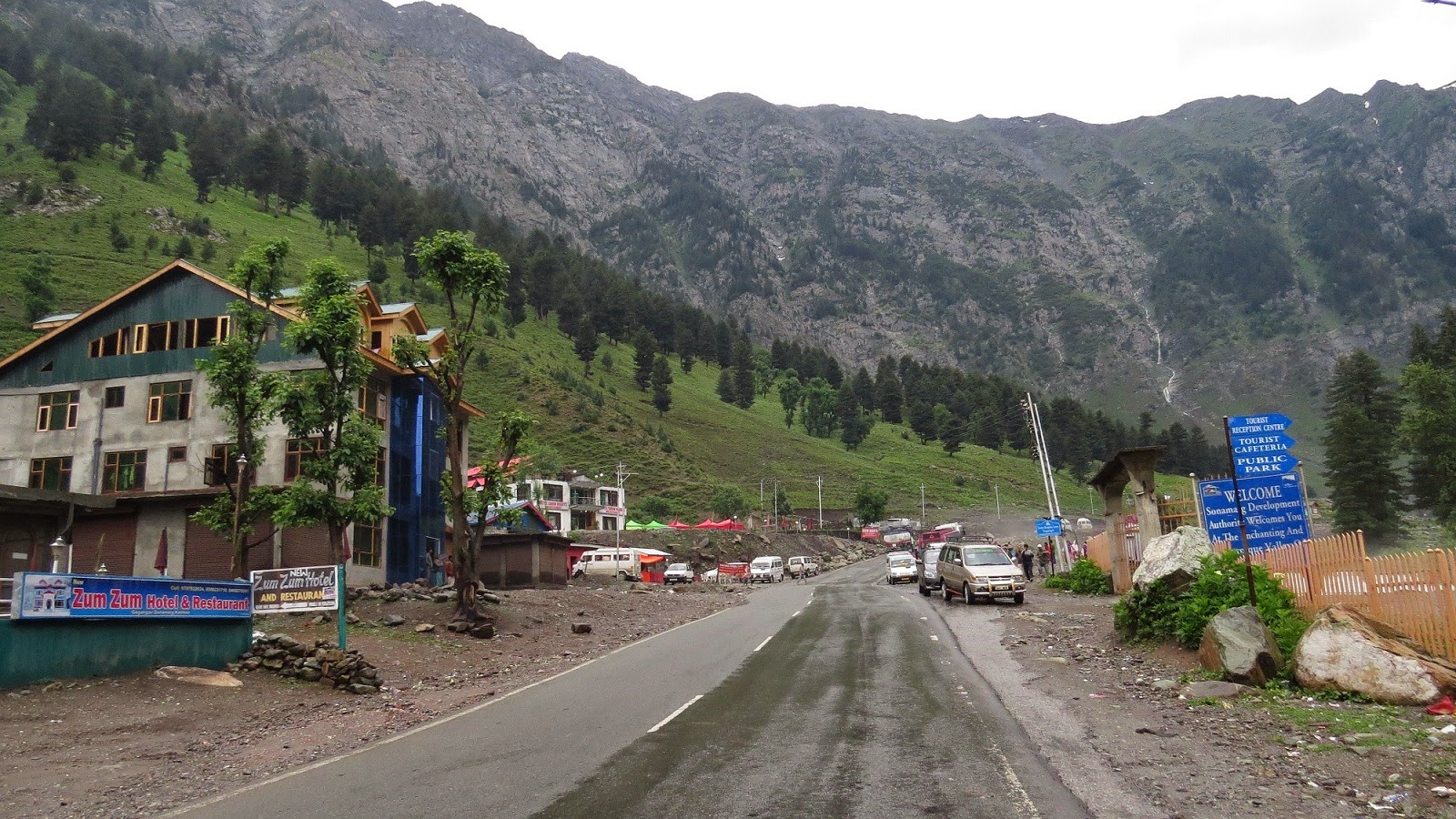
(Sonamarg view...)

Sep 24, 2012

New Delhi, Haridwar and the Himalayas…


This May, I had been on a pilgrimage across North/West India along with family and relatives. A visit to the temple town of Badrinath (Garhwal Himalayas) nestled at 3155 mtrs above sea level was the highlight of the trip and more because of the presence of ice capped mountains at the time of our visit (this being my first sights of ice and ice capped Himalayas). The holy temple of Badrinath is the most revered of the four dhams and is often referred as Bhuvaikunta (heaven on earth)!


New Delhi was burning hot (being May, it was expected) and we did some shopping at the Sarojini nagar market and visited the India Gate and enjoyed a ride in the Delhi Metro. Appreciate the taxi service (especially if hired from a known contact, our taxi men were always on time and never demanded extra fare).


The gateway to any of the 4 dhams (Chardham viz Gangotri, Yamunotri, Badrinath, Kedarnath) are the twin towns of Haridwar and Rishikesh situated on the banks of Ganga / Alakananda in the Uttarakhand. ‘Ganga Aarti’ is a main attraction at Haridwar and so does the shopping around the area. Also went on the ropeway to the Chandi devi temple and the views from the ropeway of the town was good to say the least. After a day’s rest here, we hired a tempo traveler for our group to visit Badrinath and back and the journey was no less exciting.
Another well written post by Arti of MYD on the Ganga Aarti - here - http://myyatradiary.com/2011/10/my-tryst-with-evening-ganga-arti-at-har.html

(Ganga Aarti as seen from the ropeway to Chandi devi temple)

Another notable feature is if you happen to be a 'river rafting' freak, then Rishikesh is the place to be. In Rishikesh and further, all along the river bed, you get to see lots of tents pitched up for the rafting purpose.

Seven years ago, when we had done the same trip, the roads from Haridwar onwards were narrow and a lot more riskier to drive and landslides were very common at every other nook and corner of the Himalayan Ghats. River Alakananda was a symbol of force, rage and rush all along the way and a small mistake and you would be between in a situation like “between the devil and the deep sea”; such was the risk of traveling earlier on this terrain and the risk was double during rains as that led to steady occurrences of landslides all along.

 (I could see a whole lot of bird life here, but sadly Ganges is now in a bad shape!)

But now things have changed and the single lane roads are now doubled and the travel time is considerably reduced and the risk factor too except for the last stretch between Joshimath and Badrinath. If you drive safe, it should be a problem anywhere in between. Another thing that saddened me entirely was the vanishing Ganga / Alakananda. All along the path, the intensity of river has reduced drastically and almost dry in some places thanks to many hydel projects along the way. (If I remember seeing the documentary correct on CNBC, the Ganges would diminish by 75% in few years time as it would be diverted for multiple hydel projects). The fragile eco-system of the Ghats is in for serious trouble. Back to the journey, the widening of roads, cutting of the mountains has had its impact in the sheer increase in number of landslides especially during rains :(


The drive through the Ghats is picturesque (except for the diminishing river Ganges/Alakananda) and those with motion sickness are to suffer for sure as it’s a travel with lot of curves and zig zags and hairpin bends. The mountain ranges are your constant companion interspersed with tiny villages now and then and the various ‘Prayags’ that you pass through on the way to Badrinath namely Devprayag, Rudraprayag, Karnaprayag, Nandprayag and Vishnuprayag (I would like to cite this post form Arti’s MYD that has more information about the Prayags in detail - here - http://myyatradiary.com/2011/09/panch-prayags-in-garhwal-himalayas-of.html).


As we near Chamoli and Joshimath, the terrain gets trickier and the area is prone to more landslides. One should commend BRO (Border Roads Organization) for their tireless job in ensuring the roads are cleared within minutes of a landslide happening so that there is no hamper to the traffic flow. At many places, while the clearing is going on, vehicles are allowed one at a time from either direction; these people risk their lives day in and out serving a lot for us. Hats off BRO!


As you cross Chamoli and near Joshimath (the entry gate to Badrinath), there is a gate system in place and Joshimath is also the the winter place of worship of lord Badri Vishal; the Himalayan peaks covered in ice are visible - a real treat to the sore eyes (ice caps would be only till end May and later it would be all brown/green mountains till the winter sets in again).


Joshimath is an important place acting as a base for the final journey towards Badrinath, a place at the lower altitudes, a place that can be visited throughout the year, the place when the lord Badrinath is brought down and worshipped during the winter when the temple town of Badrinath is inaccessible. A gate system is deployed here to regulate the flow of traffic between Joshimath and Badrinath.

 (the winter home of lord Badrinath... @ Joshimath)

In simple terms Gate system means the route becomes one way, i.e., if vehicles are allowed from Joshimath, vehicles from Badrinath are stopped and vice versa. It’s good as the route is quite tricky and treacherous and prone to terrific landslides. There is the lord Narasimha temple at Joshimath where lord Badrinath is brought down and worshipped during the winter months (Badrinath is inaccessible literally for 6 months in a year as its covered completely with ice during that period)!


The gates were closed at Joshimath when we reached and had to wait for an hour or so for them to allow the vehicles from here. The ice capped mountains were looking gorgeous and a human being looks so miniscule compared to them, all our feeling of greatness and invincibility is quashed within seconds in front of the mighty Himalayas. Finally, we reached the temple town by dusk and were welcomed by light drizzles and cold weather.


Next post – Badrinath and around…